Travelling in Maps: Exploring Tourist Asia (1890-1950)
Supporting the below United Nations Sustainable Development Goals:支持以下聯合國可持續發展目標:支持以下联合国可持续发展目标:


Travel has become an essential part of modern life. Nearly everyone has been a tourist at some point, stepping outside their daily routines and expecting to encounter a different world, or a somewhat “other” culture. Travel offers a sense of escape, filled with fun, pleasure, and enjoyment — what some call a “holiday”.
Before the 19th century, however, long-distance travel was far from leisurely. Journeys across continents were perilous and often life-threatening. Sea voyages were hindered by limited navigation techniques, unpredictable weather, unsanitary onboard conditions, and the constant threat of pirates. Travel by land was no safer. Those who undertook such journeys were often driven by a greater purpose, whether religious passion, the pursuit of great fortune, or coercion.
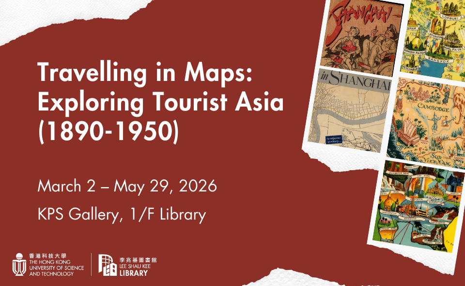
This exhibition presents a selection of travel maps of Asia created between the 1890s and 1950s. This was a transitional era in which long-distance travel expanded rapidly due to the growth of modern transportation networks, particularly railways and commercial aviation. Yet it predates the rise of mass tourism in the 1960s, a moment when cultural critics lamented that “vulgar” tourists were eroding cultural sophistication.
Featured exhibits include maps for touring Shanghai, Beijing, Taipei, and Thailand. Dive into these materials and discover how Asia was spatially visualized and explored by leisure travelers in the early 20th century — often under a Western gaze.
Opening Hours
Mar 2 – 6: 10 am – 5 pm; Mar 7 – 8: Closed
From March 9 onwards
Mon – Fri: 10 am – 5 pm
Sat & Sun: 11 am – 5 pm
Public Holidays: Closed